This project aims to observe, parse, and catalog the urban conditions of New Orleans at multiple scales. Initial explorations focused on the neighborhood of Bayou St. John, and expanded to document conditions along the industrial rail lines.
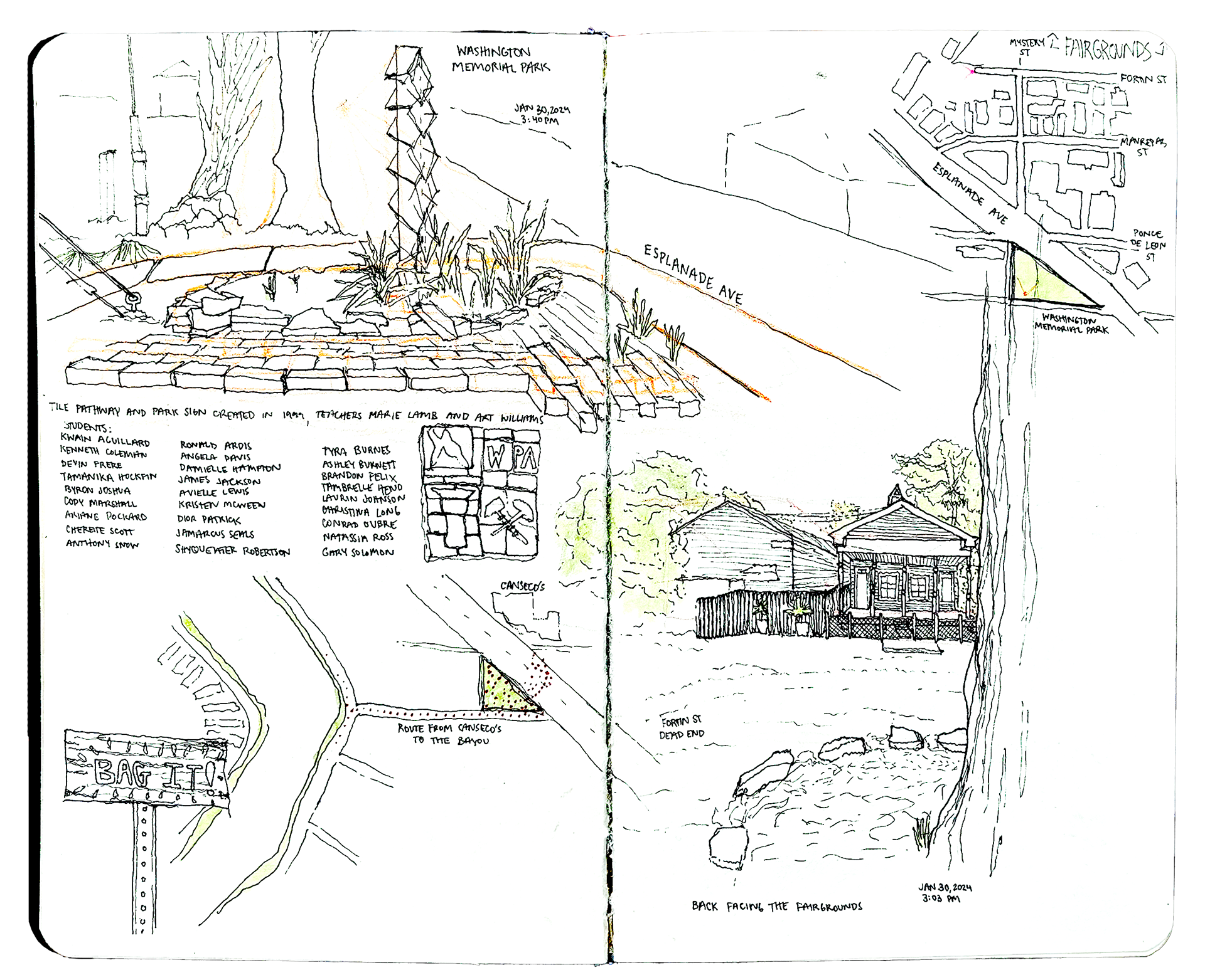
Washington Memorial Park @ Esplanade Ave and Ponce de Leon St. - January 30th, 2024
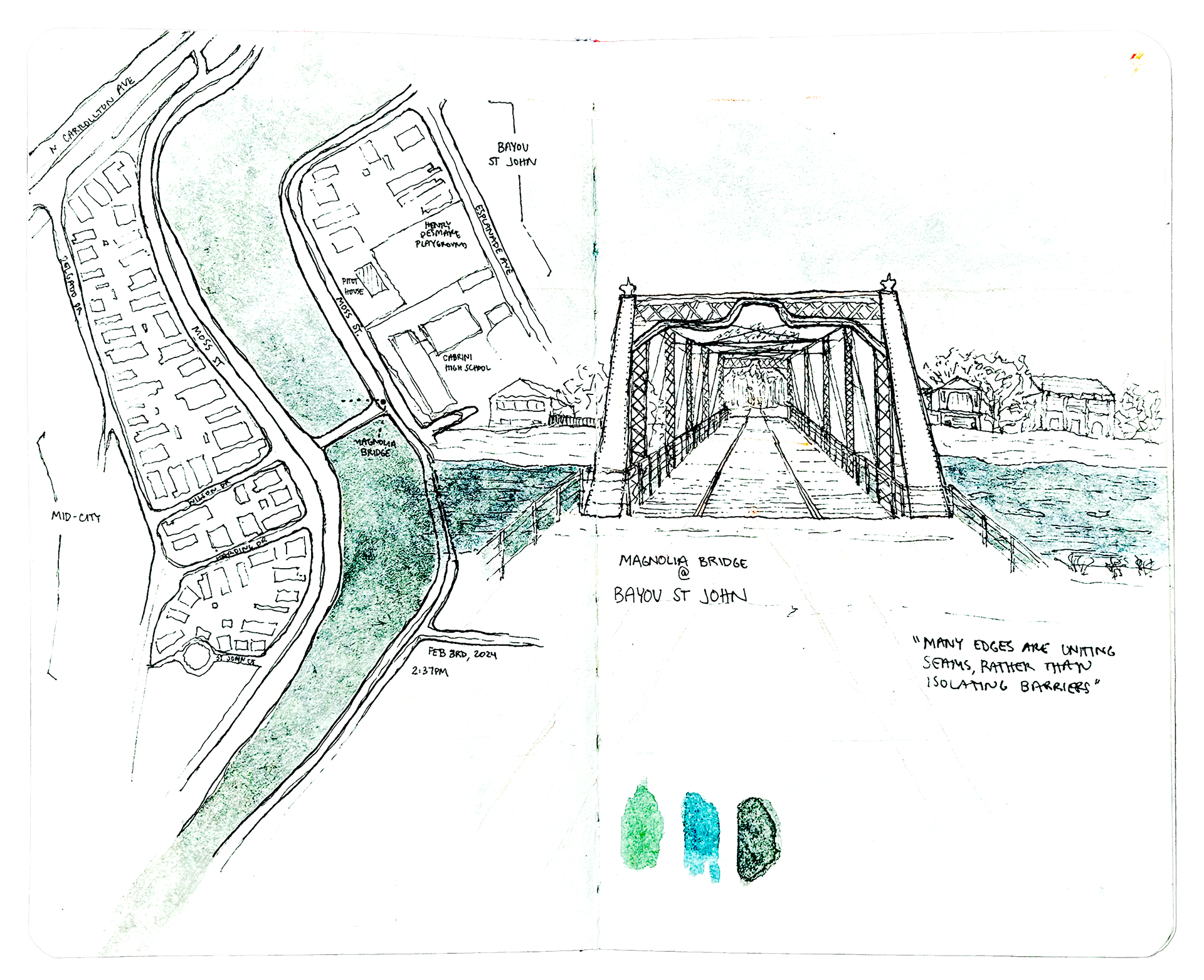
Magnolia Bridge @ Bayou St. John in front of Cabrini High School - February 3rd, 2024
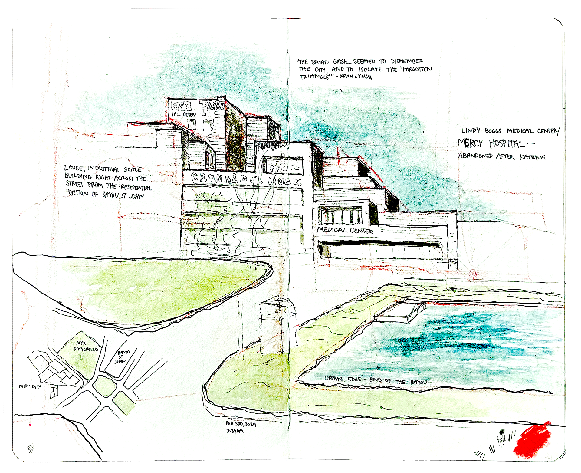
Lindy Boggs Medical Center @ Bayou St. John next to Nyx Playground - February 3rd, 2024
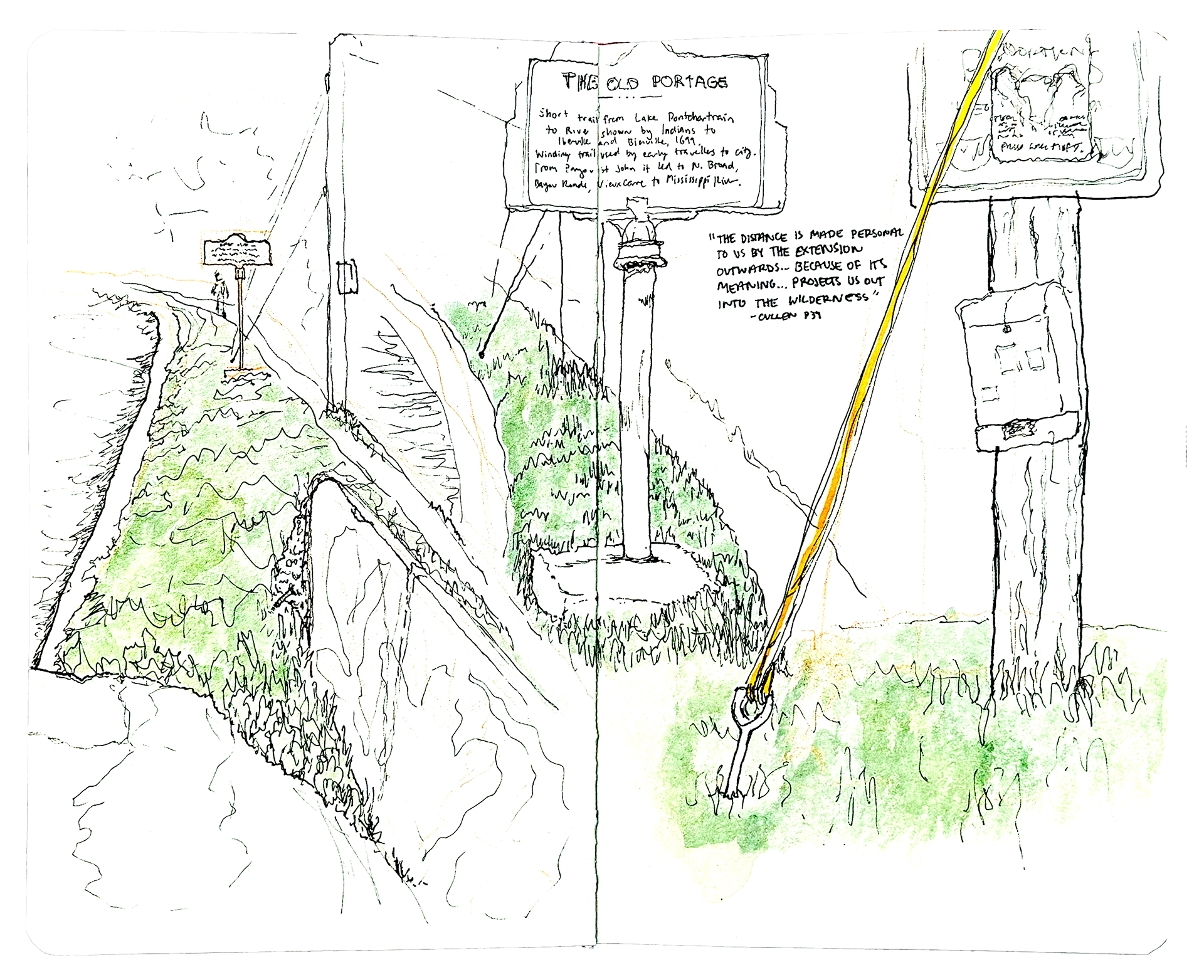
The Old Portage @ Bayou St. John, Moss St. and Bell St. - February 19th, 2024
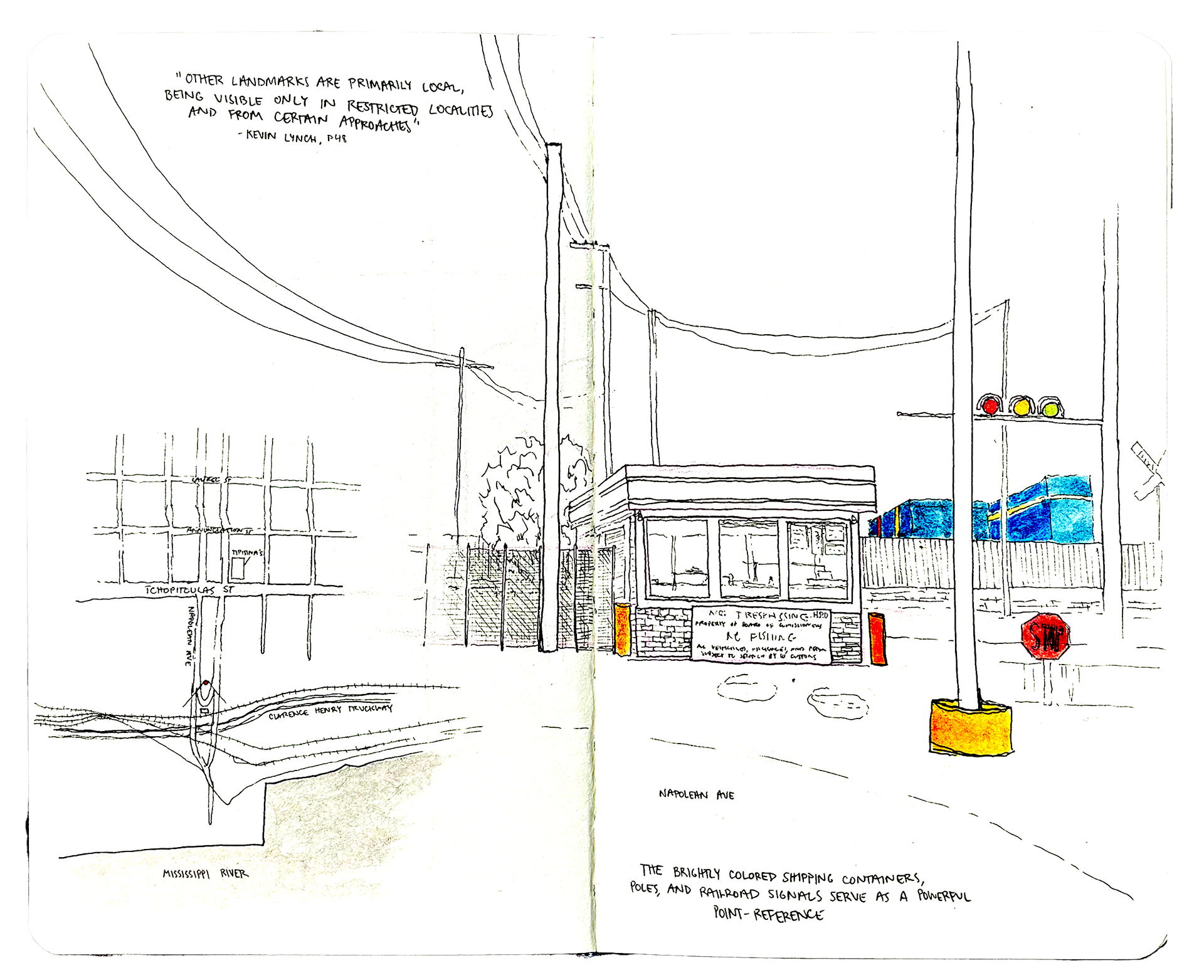
Tchoupitoulas St. and Napolean Ave, across from Tipitina's - February 28th, 2024
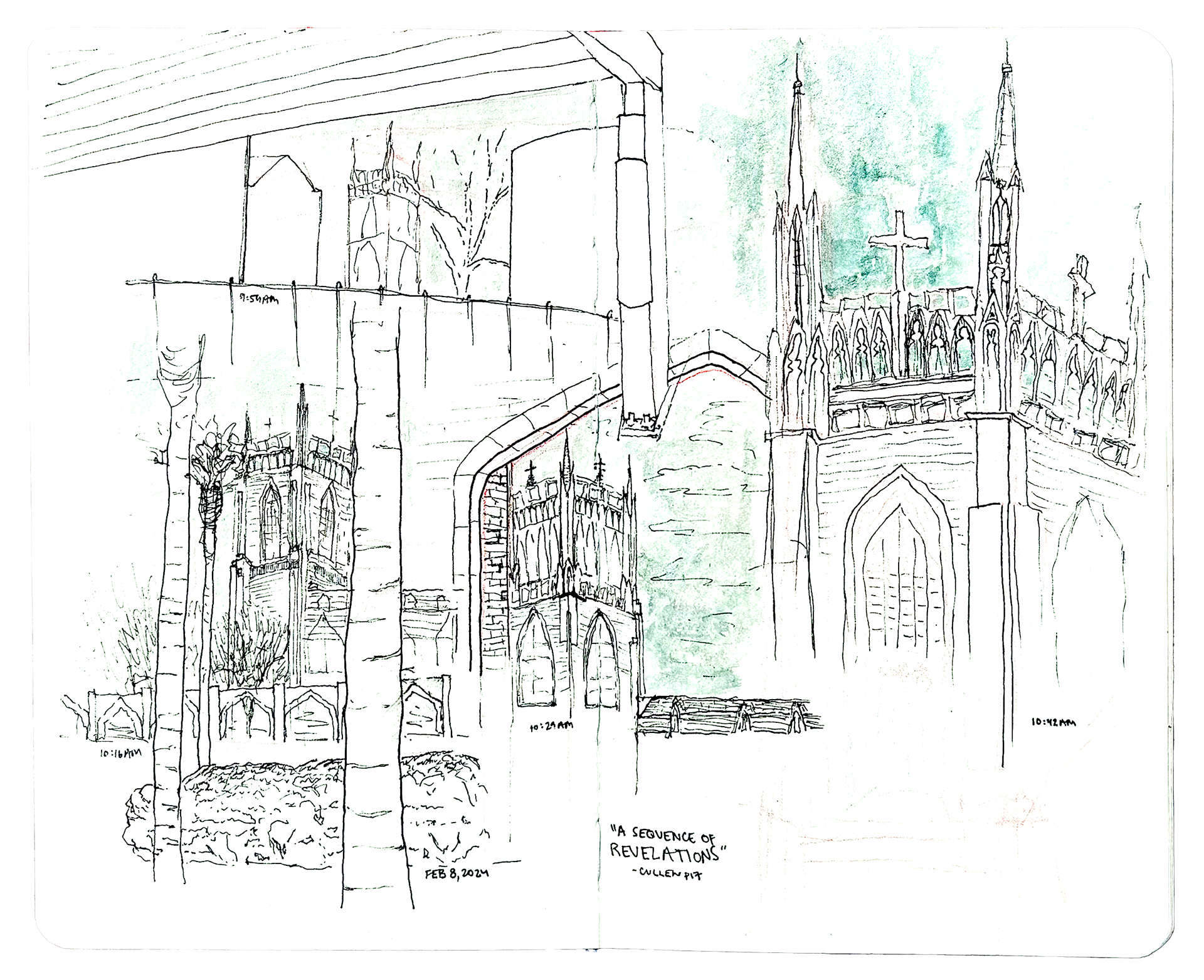
Holy Name of Jesus Church @ St. Charles Ave and throughout Loyola University - February 8th, 2024
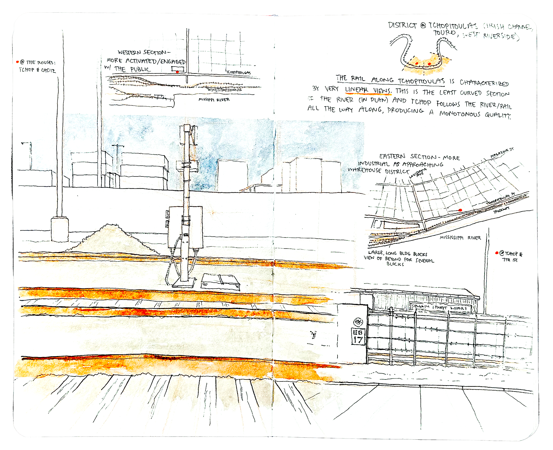
Rail Along Tchoupitoulas St. @ Cadiz St. - March 6th, 2024
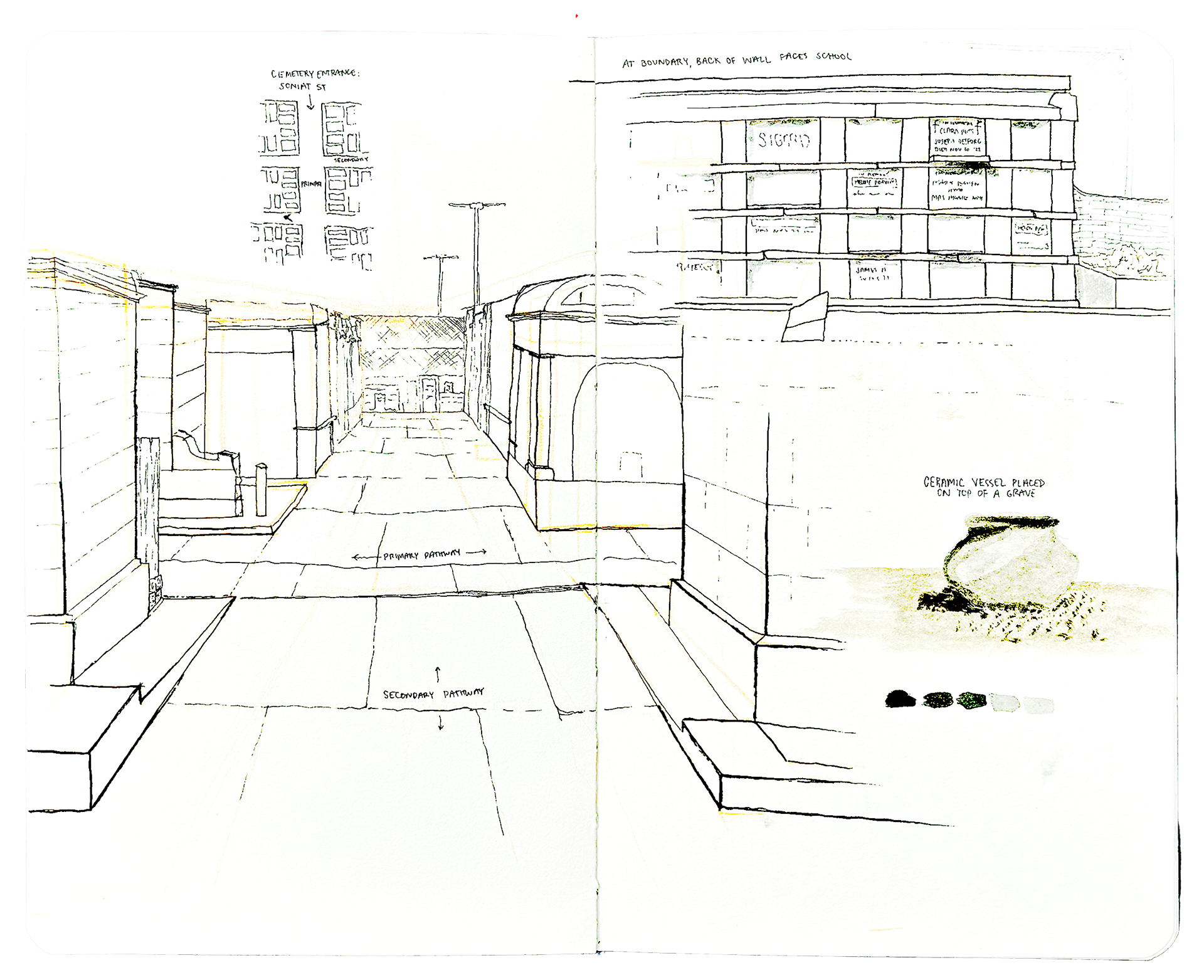
St. Vincent de Paul Cemetary No. 1 @ Soniat St. - March 17th, 2024
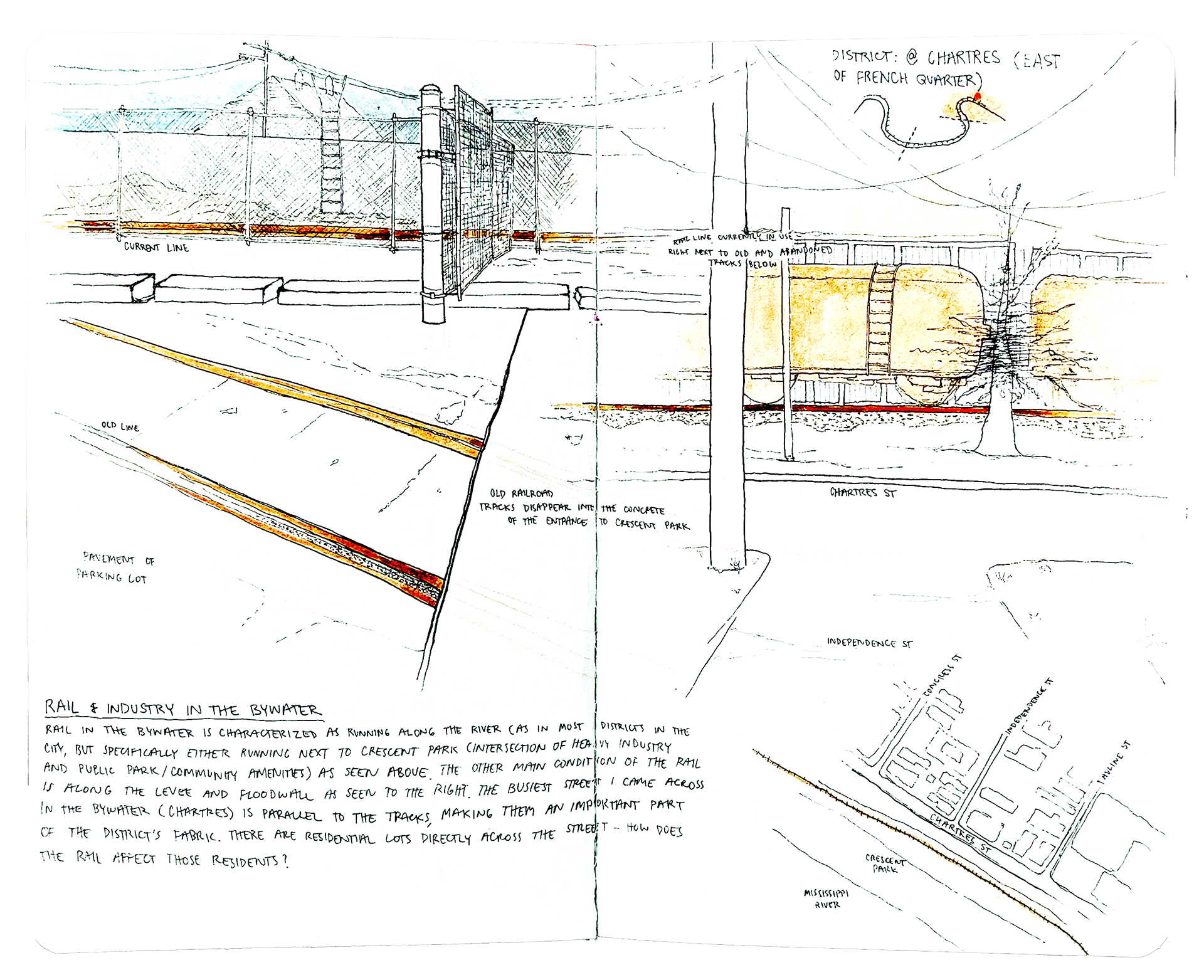
Rail in the Bywater Neighborhood @ Chartres St. and Independence St. - April 2nd, 2024
Led by Andrew Liles. 2024.